There isn’t a lot known about this location, and Corella, like many other ‘watering holes’, went on to become a government tank in its future life. However, the lease was subsequently passed in for tender by 1889 because the tank refused to hold water. In 1942 a report in the Western Herald noted that “almost fresh water was discovered at 25 feet” and a windmill was proposed to keep a ready supply, though there is no mention of a hotel by this time. A record of Corella’s Licensee appears in the History of Bourke:
MEADOWS, Thomas; carrier at Bourke (Mertin Street) in 1872. He died some time before 1879, and his wife Mabel (Wallace) on 25/05/1871. He had a wine shanty at Corella (Corilla) on the Cobar Road in 1875, and was granted a timber licence in 1878. He was married in Sydney in 1852, and had two sons and three daughters.
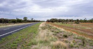
A very descriptive piece of writing in the Sydney Mail mentions ‘Corilla’ in 1937, when flood waters caused a detoured journey from Bourke to Wilcannia via Corilla, through the high, red country away from the floodplain.
THE PUNT AT TILPA, ON THE DARLING RIVER.
“Whitewoods, beefwoods, wilgas, oaks, hopbush, and wattles grew in profusion, and flocks of blue martins, zebra finches, budgerigahs, and cockatiels sheltered in the leafy branches when disturbed on the roadside.
Several creeks were crossed — Deadman’s Creek, Yanda, and Gundabooka — all of which displayed flooddetour notices. When these creeks are up the road is impassable, and the detours lead to Corilla Tank on the Cobar road to Bourke.
Over a low range of rough, stony hills, Louth was reached. Here the river was tremendous, and the small punt resembled a toy on the swollen waters.
Continuing our journey until Wimbar Creek was passed, it was decided to make camp, and an inviting place was found among some gigantic gums on the riverbank. We were greeted by the discordant cries of hundreds of red-tailed black cockatoos, into whose domain we had chanced. The scarlet bands in their tails are visible only when the birds are about to fly or alight; thus, to witness such numbers settling among the branches was a fine sight.“