The area known as ‘The Pink Hills’ was given its name by the British officer and explorer, Captain Charles Sturt on his expedition into the interior of Australia in 1828-29. Sturt was describing not the colour of the land itself, but rather the pink flowers that were growing in abundance at the time of his travels.
Combined with the relatively low height of the hills themselves, it is a name that has confused many visitors ever since.
“It was a relief to get off the flat country but we were rather disappointed at the low elevation of the Pink Hill,” wrote a correspondent of the Australian Town and Country Journal after his trip to Bourke in 1880. “Tall trees on the flat ground were higher than any hills we either crossed or saw.”
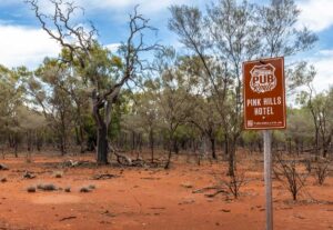
Thomas Huggins was granted the first licence for a public house at Pink Hill in 1869. According to a later account he may well have built the hotel in partnership with James Vincent, who took over the licence in 1873.
The hotel was first known as the Red House, quite possibly due to the fact that it was built from mud bricks made from red soil found at the site, but later changed to simply the Pink Hills Hotel. The hotel had six rooms, excluding those used by the family, along with fenced yards for sheep and horses.
When James Vincent died in 1879, the licence was transferred to his widow Eliza, who was still publican when the hotel was finally destroyed by fire on 9 December 1900.
Until the railway reached Bourke in 1885, the Pink Hills Hotel was a busy staging post for the mail and passenger coaches traveling between Bourke and the eastern districts.
But just as the sight of the Pink Hills failed to meet expectations, so too did the facilities available to the traveller.
“This haven of rest might by some people be considered even superior to Pink Hills Hotel,” the same disgruntled correspondent of the Australian Town and Country Journal wrote sarcastically after arriving at the Mount Oxley Hotel.
“Neither is likely ever to be imitated by any licensed victualler near Sydney who wishes to do a good business, either for architecture or cleanliness or good accommodation…”
And just a few months later, another visitor to Pink Hills wrote this account after their coach became stuck in wet weather.
“The driver, Douglas, and one passenger made for the Pink Hills Hotel with the mails, and got there after 3pm, tired, hungry and weary after their journey in the coach, and three mile tramp, when to their astonishment, they were unable to obtain either drink or refreshment until next morning.”
The first licensee Thomas Huggins went on to become well-known publican throughout the district, keeping the Royal at Louth and then the Royal at Bourke, which he sold in 1887.
In 1883, anticipating the boom in business with the coming of the railway to Bourke, Huggins had drawn up plans for a four-storey hotel and even ordered the materials to build it. The building materials were shipped, but did not arrive in Bourke for over two years, the steamer being stuck due to a low river. By then, Huggins had abandoned the idea for his hotel and sold the materials piecemeal.
A glimpse of its potential grandeur may be seen in photographs of the Commercial Bank that once stood at the corner of Sturt and Mitchell Street. Some of the pillars used in the in the building were intended for the hotel